 Images on this page
Keur Farah Pahlavi
Client: Ministry of Public Works, Government of Senegal, Her Majesty of Iran
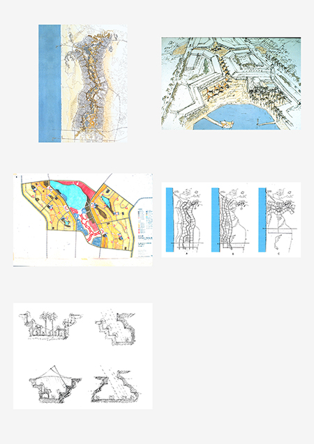
Keur Farah Pahlavi, a proposed new city for a population of 200,000, encompasses a master plan for a new industrial harbor, serving nearby phosphate mines and an oil refinery. The site selected for its construction is 100 miles north of Dakar, the capital of Senegal, on a narrow strip between dunes to the west and the bush to the east.
The physical plan follows the contours of an area known as the Niayes, fertile land characterized by sand dunes, shallow wetlands, and a network of freshwater lakes along the coastal plain.
Commerce, community institutions, and recreational facilities constitute the city’s central spine, allowing for a flexible pattern of future growth. This spinal organization frames an arrangement of natural lakes to highlight the city’s public spaces. Markets, squares, and bazaars connect by a network of pedestrian paths separate from the road system.
Materials and massing directly respond to West African culture and building traditions. Walled compound houses are composed of several structures to accommodate extended families, and ground-based dwellings form courtyards that support outdoor cooking. Housing is comprised of indigenous and locally available materials including concrete masonry with small sections of precast concrete. The first phase of the project, with construction of housing for 50,000, was interrupted due to political instability.
Images on this page: 1 Spinal site plan; 2 Aerial perspective of town center; 3 Site diagram showing neighbourhoods and town centers along the Niayes; 4 Site strategy alternatives studying relationship between city, sea, and landscape; 5 Street section studies showing relationship between building massing and sunshading
Dakar, Senegal