 Images on this page
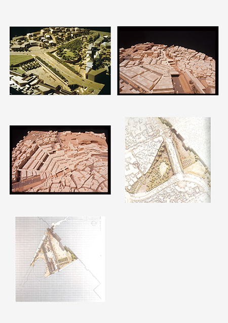
Damascus Gate Scheme 1 and 2
The area around Damascus Gate is the most active entrance to the Old City markets and the center of community life for the Arab population. The triangular precinct is bounded by the Arab business district to the east, the Jewish sector to the west, and the Old City Wall with Damascus Gate to the south. A continuous valley originally sloped from north to south through the gate, the focal point of the district. Once prominent in the landscape, Damascus Gate now appears partially sunken as the ground level has gradually risen. Inaccessible from 1948 to 1967, the area has been occupied only temporarily since then.
Hatzanchanim Street, a major road, currently divides the triangular precinct into two segments, north and south. The recently constructed Highway 1 runs along the edge of the precinct and, with its acoustic baffle walls, has been criticized for separating the eastern and western parts of the city almost as brutally as the old barbed wire on the Jordanian-Israeli border. Over a period of twenty years, Safdie proposed two distinct schemes to manage traffic and regional transportation issues, with the common goal of balancing pedestrian and commercial activities at this pivotal location.
Images on this page: 1 Aerial view of physical model; 2 View of physical model; 3 View of physical model; 4 Upper level plan; 5 Lower level plan
Jerusalem, Israel